
Feedback archive → Feedback 2015
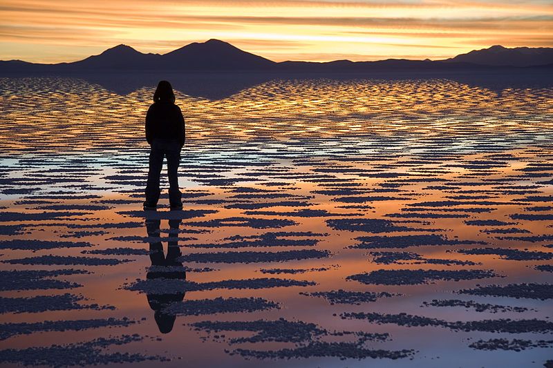
Lithium deposits at Salar de Uyuni, Bolivia

Today’s feedback comes from Alfred K. of Australia asking about Bolivia’s Salar de Uyuni and the origin of the lithium deposits there. It is answered by CMI geologist Dr Tas Walker.
To me, Bolivia’s Salar de Uyuni salt flats seem to be a geological anomaly at 3600 meters altitude. Do you have any comments on its formation and why it has such a high concentration of lithium? Thank you.
Alfred K.

Hi Alfred,
I’m regularly asked about geological features that I have not previously encountered or studied. The earth is huge, and there are innumerable amazing features that can keep us fascinated for a lifetime. I’ve set out in a few articles (e.g.https://creation.com/maui-hawaiian-island)1 how I begin to research such topics, and this may be of help to you. The Bible provides a framework of thinking in its recorded history that will greatly help you to understand the world around you.
From your inquiry I Googled “Bolivia’s Salar de Uyuni salt flats” and found lots of articles including a Wikipedia entry (http://en.wikipedia.org/wiki/Salar_de_Uyuni).2 Of course, Wikipedia is not the most reliable source, and it changes, but it can provide a reasonable start for your quest, and suggest places to look for more reliable information. I’ve reproduced below some excerpts of the Wikipedia entry along with some comments of mine. These are thoughts that come to me as I research and read on a geological topic. Of course, these preliminary ideas would need to be researched in more detail from more soundly based sources.
In the section entitled, “Formation, geology and climate” the Wikipedia entry says Salar de Uyuni is part of the Altiplano in southwest Bolivia, South America. It is composed of a salt surface crust overlying brine saturated sediments. Further:
The Altiplano is a high plateau, which was formed during uplift of the Andes mountains. The plateau includes fresh and saltwater lakes as well as salt flats and is surrounded by mountains with no drainage outlets.
When I read “uplift of the Andes” I connect that with the uplift of the continents mid-way through Noah’s Flood, which occurred about 4,500 years ago. The Flood lasted about a year, and the waters took about 7 months to drain from the earth. This uplift was the last major uplift of the continents, which formed the present-day mountains.3 The waters had inundated the whole earth at this time, and were covering every high mountain. The uplift of the continents signalled the beginning of the retreat of the floodwaters into the oceans. You can read about what was happening in Genesis 8.
When I read “high plateau” I connect the formation of that flat surface to the erosion of the continents by the receding waters of the Flood. Initially, these waters covered the whole continent and were flowing off in wide sheets. That’s why the formation of the plateau was connected with the uplift of the continents and the receding floodwaters. There are many articles on creation.com about these plateau features around the world.4 In fact, it is only the receding waters of Noah’s Flood that explain these flat plateaus at high elevation.
The “fresh and saltwater lakes” mentioned are present–day lakes, and presumably their water quality would relate to whether or not the lakes have an outlet. If they have no outlet they would likely be salt water. For a lake to be fresh it would need an outlet.
The description, “salt flats surrounded by mountains with no drainage outlets” suggests that these areas were likely still full of water after all the other water from the Flood had receded.5 This water that remained trapped from the Flood would have contained lots of unusual chemicals and organic material that accumulated during the Flood, quite different in composition from the sort of environments that are found today. The waters were also likely warmer than for similar lakes today.
The Wikipedia article continues:
“The geological history of the Salar is associated with a sequential transformation between several vast lakes.”
The description “vast lakes” suggest the water was left over from the Flood. The term “sequential transformation” describes the changes that occurred in the 4,500 years after the Flood. We would expect the composition of the water in the lakes to change with the establishment of regular rainfall. Also, we would anticipate that the large enclosed water bodies would reduce in volume with evaporation over decades and centuries, concentrating the salts in water. We would also expect sedimentation in the lakes and erosion of the water courses to modify the size and shape of the system, over the centuries.
The Wikipedia article continues with lots of information, not all of which is important unless you want to get into the details:
Some 30,000 to 42,000 years ago, the area was part of a giant prehistoric lake, Lake Minchin. Its age was estimated from radiocarbon dating of shells from outcropping sediments and carbonate reefs and varies between reported studies. Lake Minchin (named after Juan B. Minchin of Oruro) later transformed into paleolake Tauca having a maximal depth of 140 meters (460 ft), and an estimated age of 13,000 to 18,000 or 14,900 to 26,100 years, depending on the source. The youngest prehistoric lake was Coipasa, which was radiocarbon dated to 11,500 to 13,400 years ago. When it dried, it left behind two modern lakes, Poopó Lake and Uru Uru Lake, and two major salt deserts, Salar de Coipasa and the larger Salar de Uyuni. Salar de Uyuni spreads over 10,582 square kilometers (4,086 sq mi), which is roughly 100 times the size of the Bonneville Salt Flats in the United States. Lake Poopó is a neighbor of the much larger Lake Titicaca. During the wet season, Titicaca overflows and discharges into Poopó, which, in turn, floods Salar De Coipasa and Salar de Uyuni.
The carbon-14 ‘dates’ for the “giant prehistoric lake” of 30,000 to 42,000 years are consistent with material deposited from the Flood—that is material that was ripped up from the pre-Flood world.6 Most wood and organic material found in Flood sediments gives ‘ages’ in this range.7 So these dates suggest the prehistoric lake is a very late-Flood feature, which is consistent with our earlier idea above that the enclosed lake was left over water from the Flood. The other carbon-14 ‘dates’ ranging from 11,500 to 26,100 would be related to features that developed at or after the Ice Age maximum (which uniformitarians say was 22,000 years ago, but which corresponds to around 4,000 years ago in real time).8 The Ice Age occurred after the Flood.
More from Wikipedia:
Lacustrine [lake] mud that is interbedded with salt and saturated with brine underlies the surface of Salar de Uyuni. The brine is a saturated solution of sodium chloride, lithium chloride and magnesium chloride in water. It is covered with a solid salt crust varying in thickness between tens of centimeters and a few meters. The center of the Salar contains a few ‘islands’, the remains of the tops of ancient volcanoes submerged during the era of Lake Minchin. They include unusual and fragile coral-like structures and deposits that often consist of fossils and algae.
The lithium is present as a salt, lithium chloride, which would have accumulated as evaporation concentrated the salt in the remaining liquid and reduced the size of the lake. Note that the centre of The Salar contains a few ‘islands’ which are the remains of the tops of ancient volcanoes submerged during the era of Lake Minchin. Thus, these volcanoes would likely be late- or post-Flood eruptions, and may have some connection with the origin of the lithium, as we will see later.
According to Wikipedia, lithium is one of the most important minerals at Salar de Uyuni, being a vital component of many electric batteries. Bolivia holds over 40% of the world’s lithium reserves, most of which are located in the Salar de Uyuni. Wikipedia further says that Lithium is concentrated in the brine under the salt crust at a relatively high concentration of about 0.3%. It is also present in the top layers of the porous halite body lying under the brine.
Google also helps answer where the lithium may have come, turning up an article on Earth Science Beta with two proposals.9 The first is from a paper from Economic Geology in 2013 by researchers Hofstra, et al. They reported investigations into similar lithium brine deposits in the United States, and extended their results to Salar de Uyuni.10 They concluded that meteoric water (e.g. rainwater) leached the lithium from volcanic deposits in the Bolivian tin belts to the east, and carried it into the Salar de Uyuni.
Another idea from Earth Science Beta suggests the lithium is carried in by magmatic water (i.e. directly from hot volcanic sources under the earth) in addition to meteoric sources.11,12 We have already noted the volcanic islands within the Salar and these may have been connected with the origin of the lithium in some way. From a big-picture point of view there is not a lot of difference between the two ideas.
Thus, within a biblical interpretation, these ideas for the origin of the lithium indicate it could have accumulated at the very tail-end of the Flood as the floodwaters were draining, and continued to accumulate in the centuries and millennia in the post-Flood period. The timing of the accumulations and relative quantities involved at different times would be something that you could investigate by further searching.
This is a preliminary answer to your brief question in your email. I have set out how you can think about the problem and connect it with the true history of the earth as recorded in the Bible. The Bible provides a framework for thinking, which is what I have outlined above. However, in order to speak with more confidence on the question, every speculation and idea that I describe above needs to be checked and confirmed from research published on the various geological issues, by looking at geological maps, and by checking Google Maps and Google Earth. Often it is not easy to distinguish between late-Flood and early-post-Flood features. If you want more soundly-based conclusions you will need to do more research yourself, consulting the published literature on the various relevant topics.
All the best,
Tas Walker
Scientist, writer, speaker
References and notes
- Haleakala volcano on the Island of Maui, Hawaii, https://creation.com/maui-hawaiian-island, Accessed 13 Jan, 2015. Return to text.
- Salar de Uyuni, http://en.wikipedia.org/wiki/Salar_de_Uyuni, Accessed 13 Jan, 2015. Return to text.
- Oard, M.J., The mountains rose, A review of: The Origin of Mountains, Edited by Cliff Ollier and Colin Pain, Routledge, London 2000, J. Creation 16(3):40–43, 2002; https://creation.com/mountains-rose. Return to text.
- For example, Oard, M., It’s plain to see. Flat land surfaces are strong evidence for the Genesis Flood, Creation 28(2):34–37, 2006; https://creation.com/plain. Return to text.
- For an example of water enclosed on the continents see, Scheele, P., A receding Flood scenario for the origin of the Grand Canyon, J. Creation 24(3):106–116, 2010; https://creation.com/grand-canyon-origin-flood. In this example the receding floodwaters were temporarily trapped in an enormous area but eventually drained. Return to text.
- See: What about carbon dating? Batten, D. (ed.), The Creation Answers Book, 6th ed. ch. 4, pp. 65–84, p. 69, 2014; https://dl0.creation.com/articles/p099/c09940/chapter4.pdf. Return to text.
- See examples at: Snelling, A., Radioactive ‘dating’ in conflict! Fossil wood in ‘ancient’ lava flow yields radiocarbon, Creation 20(1):24–27, 1997; https://creation.com/radioactive-dating-in-conflict. Return to text.
- Walker, T., A preliminary age calibration for the post-glacial-maximum period, J. Creation 29(1), 2015; also at http://biblicalgeology.net/blog/preliminary-age-calibration-for-post-glacial-maximum-period/. Return to text.
- Where does the lithium in Salar de Uyuni comes from? Stack Exchange, Earth Science Beta, gives two answers to the for the origin of the lithium; http://earthscience.stackexchange.com/questions/3121/where-does-the-lithium-in-salar-de-uyuni-comes-from; Also cited at that link is: François Risacher, F., Hugo Alonsob, H., and Carlos Salazarc, C., The origin of brines and salts in Chilean salars: a hydrochemical review, Earth-Science Reviews 63(3–4):249–293, 2003;http://www.sciencedirect.com/science/article/pii/S0012825203000370 which presents a different scenario for the origin of the lithium. Return to text.
- Hofstra, A.H., Todorov, T.I., Mercer, C.N., Adams, D.T., and Marsh, E.E., Silicate Melt Inclusion Evidence for Extreme Pre-eruptive Enrichment and Post-eruptive Depletion of Lithium in Silicic Volcanic Rocks of the Western United States: Implications for the Origin of Lithium-Rich Brines, Economic Geology 108(7):1691–1701, 2013; doi:10.2113/econgeo.108.7.1691; http://econgeol.geoscienceworld.org/content/108/7/1691.abstract. Return to text.
- Daisuke Araoka, Hodaka Kawahata, Tetsuichi Takagi, Yasushi Watanabe, Koshi Nishimura, Yoshiro Nishio, Lithium and strontium isotopic systematics in playas in Nevada, USA: constraints on the origin of lithium, Mineralium Deposita 49(3):371–379, 2014; http://link.springer.com/article/10.1007/s00126-013-0495-y. Return to text.
- Also cited for a magmatic origin is: François Risacher, F., Hugo Alonsob, H., and Carlos Salazarc, C., The origin of brines and salts in Chilean salars: a hydrochemical review, Earth-Science Reviews 63(3–4):249–293, 2003; http://www.sciencedirect.com/science/article/pii/S0012825203000370. Return to text.


Readers’ comments
Comments are automatically closed 14 days after publication.