

Special report: Amazing ‘Ark’ exposé
Spectacular claims, a misleading video, people misquoted and misrepresented … it’ no wonder many have asked the question … could this be Noah’s ark?
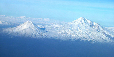
No matter where you live, if you haven’t already heard about it, the promoters and the media have been making sure you will. What then is the massive boat-shaped formation which rests at 6,300 feet above sea level in Eastern Turkey, about 12–15 miles (15–24 kilometres) from the summit of Greater Mount Ararat?
| The Main Claims at a Glance | True/False? |
|---|---|
| Radar shows man-made (boat) structure | FALSE |
| There is a regular metallic pattern | FALSE |
| Lab tests show petrified laminated wood | FALSE |
| Turkish scientists found metal rods | FALSE |
| Metal artefacts have been proved by lab | FALSE |
| There are ‘ship’s ribs’ showing | FALSE |
| There is lots of petrified wood | FALSE |
| Turkish Commission says ‘it’s a boat’ | FALSE |
[Ed. note: see also:
- Refutation of Mary Wyatt’s ‘rebuttal’ of this article
- Has the Ark of the Covenant been found?
- Who really sunk the ‘Noah’s Ark’ site?]
Introduction

Apparently first seen by a local Kurdish farmer following an earthquake in May 1948, the world’s attention was drawn to this streamlined boat-shape by the publication of an aerial photograph, taken by a Turkish Air Force pilot, in Australian Pix magazine on July 9, 1960 and American Life magazine on September 5, 1960. Another earthquake in December 1978 is said to have enhanced the relief between the boat-shaped formation and the surrounding terrain, although erosion has since been actively modifying it.
However, this particular boat-shape is far from unique. The Turkish Air Force released another photograph (click here to see picture) several years ago showing three similar boat-shapes in the mudflow material on the footslopes of nearby Lesser Mount Ararat. So in reality, if it wasn’t for the fact that this particular boat-shape is the approximate length of the biblical Noah’s Ark* then little attention would have been paid to it, even though it lies within the region the Bible describes as the mountains of Ararat (Genesis 8:4). (*It is much wider than the Ark, but proponents of the site say that this is because the outside walls have been ‘splayed out’ by the weight of mud.)
Claims about this boat-shape were previously discussed in Creation 12(4):16–19, September 1990. The site is properly known as the Durupinar site, named after the Turkish Army Captain who first saw the boat-shape on the aerial photograph and who was involved in the first expedition in 1960. Some more recently have called it the Akyayla site, after the region in which it is located. The site has been vigorously promoted by self-styled archaeologist and explorer Ron Wyatt since 1977, when he first visited Turkey and began investigations. Over the years, particularly in the mid-1980s, Wyatt repeatedly tried to interest other people in the site, such as former US astronaut Colonel James Irwin, and ICR scientist Dr John Morris. Neither of these men were convinced after on site inspections. In 1985 Wyatt was joined by former merchant marine officer David Fasold and geophysicist Dr John Baumgardner. Both men have since parted company with Wyatt, Fasold disagreeing with him over details, and Baumgardner, while originally being cautiously enthusiastic, is now adamant the site does not contain Noah’s Ark.

The yellow tapes allegedly show regular ‘grids’ of metal objects. This has been shown to be a false claim.
Australian Dr Allen Roberts first visited the site in 1990 and thereafter initiated the organization Ark Search in order to raise funds to work with Wyatt on an archaeological dig. Their efforts came to world media attention when they were kidnapped (with three others) and held captive by Kurdish guerrillas for three weeks in September 1991.
Both Wyatt and Roberts continue to actively promote the site as the probable remains of Noah’s Ark. In recent years Wyatt was interviewed on a number of US television programs, the footage of which he combined with his team’s on-site footage to make a video that has been widely marketed/circulated among many Christians, who have thus become excited about the possibility that Noah’s Ark has supposedly been found. Meanwhile, during the first half of 1992, Dr Allen Roberts embarked on a systematic Australia-wide lecture tour, and his Ark Search organization produced a booklet summarizing their evidence and marketed a video of his public lecture.
With this brief background we now evaluate the evidence claim by claim and respond. Unfortunately, not one of these seemingly convincing claims stands up.
Metal Detectors and Hot Spots
It is Alleged That
Metal detector surveys found a regular pattern of ‘hot spots’ which could be joined to reveal a regular pattern of ‘lines’ lengthwise and across the inside of the formation only. These ‘hot spots’ represent iron concentrations and could be traced by the metal detector along these interconnecting lines or ‘iron lines’.
A standard beach combing type metal detector (the type with a disc-shaped detector head on the end of a long pole) ‘hot spots’ were indeed found, but these were randomly distributed and not in a regular pattern along lines. Since this type of metal detector can only detect metal objects down to a depth of about 1 foot (30 centimetres), these ‘hot spots’ can only represent objects with high metal concentrations buried in the surface mudflow material. Such a description perfectly fits the numerous basalt (a volcanic rock that is everywhere throughout the area) boulders found randomly buried in, and protruding from, the mud. The basalt boulders are often weathered but contain iron oxides that make the instrument respond positively in contrast to the ‘dead’ mud. Furthermore, this instrument did not detect ‘iron lines’ between the ‘hot spots’. That this distribution of ‘hot spots’ was random was confirmed by at least two such metal detector surveys.
Metal Detectors Mapping Iron Lines
It is Alleged That
Metal detecting surveys using a ‘molecular frequency generator/discriminator’ mapped out these ‘iron lines’, which represent longitudinal and cross beams containing iron nails and /or brackets. (These ‘iron lines’ were marked out with bright yellow plastic tape for greater impact.)
A ‘molecular frequency generator’ consists of a pair of brass welding rods bent at 90 degrees near one end, which are placed in sleeves for ease of movement while hand-held, connected by wires to a set of batteries which are carried in the operator’s pocket. (This electrical source is supposed to make the device more sensitive!) A so-called frequency generator is placed on the ground within the area to be surveyed. The dials are set on this ‘instrument’ for it to emit the supposed inaudible frequency of whatever metal (gold, iron, etc.) one hopes to detect. As the operator walks along holding the brass rods out in front, one in each hand, the rods are supposed to cross or separate when the subsurface target is located. Such movement, however, will occur by simple physical principles even when there are no batteries connected. Just as a supermarket trolley (castor) wheel tends to trail behind the direction of motion, there is a tendency for the long arms of the rods to rotate so as to trail behind the direction of walking. The resultant crossing or separating may therefore easily be initiated by the conscious or unconscious expectations of the user.
Qualified scientists have been independently consulted about this gadget, which is generally advertised in treasure-hunting magazines, not scientific journals. They are unanimous that there are no scientific principles employed. Indeed, two of these scientists built and tested working models. The results of this technique can hardly be considered trustworthy, the brass welding rods being used in essence, as divining rods, similar to the use of a forked stick to search for water.* So the ‘iron lines’ on diagrams of the boat shape and the lines of plastic tape in photographs are only an interpretation based on ‘results’ from a pseudo-scientific ‘instrument’. They have not been able to be reproduced or verified by any reputable scientific survey technique, including standard metal detection equipment. This includes the highly sophisticated types of magnetometer used by mining companies (see later). (*Even Baumgardner, to his later embarrassment, was initially taken in by the false claims attributed to this ‘instrument’. Fasold still promotes its virtues and cries ‘foul’ when these ‘home truths’ are pointed out, yet if it were what he claims then every mining company and fortune seeker would own and operate one and be making hordes of money! No mining company uses anything like it.)
Ground Penetrating, Subsurface Interface, and Radar Surveys
It is Alleged That

The pattern of ‘iron lines’ that was located by the metal detecting surveys and marked out by plastic tape was duplicated and verified by other subsurface techniques including ground penetrating, or subsurface interface, radar surveys, particularly the radar scans obtained by Fasold and Wyatt. These radar scans showed an internal structure typical of a boat’s structural framework (‘bulkheads’, ‘keelsons’, ‘walls’, etc.). Tom Fenner of Geophysical Survey Systems Inc. has thus designated the formation as a man-made boat.
In Reality
This claim is utterly false, yet it has been persistently used to give credence to diagrams purporting to show the internal structure of a boat, namely Noah’s Ark. Both Baumgardner and Dr William Shea were in Turkey in June–July 1986 waiting to join Wyatt on site. Wyatt and Fasold told them that they went to the site without a permit and in 30 minutes made 10 passes with the radar scanner only over the southernmost portion of the boat-shape, the so-called ‘prow’. Upon rendezvousing with Shea, Wyatt provided him with copies of these radar scans. Shea has forwarded them to us.
The permit was eventually approved, but Wyatt, Fasold and their party were not allowed back to the site with the radar scanner by the local police and military, so the planned follow-up work to radar scan the whole formation never came to pass, at least not at the hands of Wyatt and Fasold, from all published accounts. Yet, Wyatt and Roberts have both published diagrams of the boat-shape showing a supposed internal structure of transverse and longitudinal divisions which they have labelled as ‘bulkheads’ and ‘gunwales’ over the whole ‘boat’, the latter referencing Fasold’s 1986 survey of only part of it.
Furthermore, both Wyatt and Roberts legitimize these claims by using the name of Tom Fenner of Geophysical Survey Systems Incorporated in New Hampshire, who they say looked at the 1986 radar scans and concluded that the formation is ‘a man-made boat’.
So what did these radar scans really show? There are a series of laterally periodic narrow reflections stacked in column-like ‘structures’ at approximately the same depth. Roughly equidistant, they may give a ‘non-natural’ impression at first glance. Fasold called these the ‘subsurface walls’ he thought he had initially ‘detected’ with the ‘molecular frequency generator’ and plotted them as ‘bulkheads’ and ‘gunwales’ on diagrams. However, this interpretation of these radar scans does not take into account the crucial topographic (surface) variations across the site. If it did, Wyatt and Fasold would never have been able to convince themselves, let alone anyone else, about these so-called ‘bulkheads’, etc. Interestingly, Fasold admits on one of his published radar scans that the radar missed some of these so-called ‘walls’.
Geophysicist Tom Fenner says, ‘I was surprised and dismayed to learn that Mr Wyatt was using my name as well as the name of Geophysical Survey Systems Inc. (GSSI) in order to lend credibility to his unsubstantiated claims concerning the so-called “Noah’s Ark site.”’ Fenner goes on to indicate that neither he nor GSSI believes the formation to be manmade. He writes, ‘In 1987 I performed an extensive GPR [ground-penetrating radar] study in an attempt to characterize any shallow subsurface features in the boat-shaped formation at the site… . A great deal of effort was put into repeating the radar measurements acquired in 1986 by Wyatt and Fasold… . After numerous attempts over a period of one and a half days we were unable to duplicate their radar records in any way…. I was never convinced the site was the remains of Noah’s Ark. In fact the more time I spent on the site, the more skeptical I became.’
Instead of finding ‘walls’, Fenner’s 1987 radar survey indicated the presence of a shallow flat-lying reflector likely to be bedrock underneath the surface mudflow material. On the other hand, speaking of the data from the Wyatt and Fasold survey (which could not be duplicated, anyway) Fenner comments, ‘Their records showed point targets’, not ‘walls’. In other words, no boat structures (for example, ‘bulkheads’ or ‘gunwales’) were found in the survey that was conducted by a professional ground penetrating radar operator. Wyatt even claimed his radar scans showed stairs, which is absolutely unsustainable.
Walls of the Boat
It is Alleged That
In the walls that define the outline of the boat-shape is evidence of a former ship’s ribs, presumably the timbers that formed part of the original keel structure/hull (‘a few beams protruding out’).
In Reality
These walls, in places standing 20–30 metres (70 feet) sheer above the immediately surrounding terrain, certainly give the impression of the outer hull of a boat. However, that is where all similarity ends. These walls are simply hardened mud, containing boulders of the various local rock types. They contain no petrified wood holding in the mud in any way reminiscent of the outer planking of a wooden hulled vessel.
Furthermore, closer examination of the photographic ‘evidence’ of a ship’s ribs reveals that erosion gullies cutting into the walls at fairly regular intervals, mainly in one area, have given the appearance at a distance of thick beam structures; however, they are merely the hardened mud left behind between these erosion gullies.
As the burden of proof rests with those who claim that these are a ship’s ribs, one would have thought that they would have sampled this material and submitted it for scientific tests. However, there is no indication that it has ever been sampled by Wyatt or Roberts to see what they really are. On the other hand, all the other eye witnesses who have been to the site insist that they only ever saw mud, containing boulders (mudflow debris), forming these walls.
Trainloads of Petrified Wood?
It is Alleged That
‘There are trainloads and boatloads of petrified wood out there and it is all in the boat structure.’ Furthermore, the prized exhibit Wyatt shows to visitors, and photographs of which are regularly displayed, is a sample of “petrified” wood identified as pecky cypress-removed from inside the “hull” in the presence of the Governor of Agri.’
In Reality

No trained scientist of the many who have visited the site has ever seen any sign of these ‘trainloads’ of petrified wood. Geologist Dr Bayraktutan has collected one or two small fragments of semi-petrified wood which in his opinion have flowed on to the site within the mud from elsewhere. He confirms that none of the regular rock types of the site are petrified wood. Not one of the other scientists (including geologists familiar with petrified wood) has ever once seen any. Yet Wyatt continues to show untrained people samples of what he claims is petrified wood from the site.
His prize sample, reportedly dug up in the presence of the Governor of the Turkish province of Agri, is not only claimed to be petrified wood, but alleged to be ‘laminated’ and ‘deck timber’. Roberts too has made much of this sample, being photographed with it, and claiming that this ‘petrified laminated timber’ is of major significance, since the Ark was made of gopher wood which, he says, could mean laminated wood.
Both Wyatt and Roberts claim support for the identification of this sample by citing Galbraith Laboratories of Tennessee, yet the laboratory assay certificate shows that they only analysed for three elements-calcium, iron and carbon-no basis at all for calling the sample petrified wood! When telephoned, the laboratory was adamant that they were not asked to give an opinion on what the object was and they were unable to do so.
The only other supportive evidence revealed by Roberts privately was a typewritten statement claiming that the sample (which is said to have no growth rings*) had been ‘identified visually as pecky cypress by John Mackay’. That is all. No one should make such an identification without a microscope thin section which would show, if the sample really was petrified wood, the cellular wood structure. No such thin sectioning has been done, and when urged by Roberts’ group Ark Search to do so (after Creation Science Foundation pointed this out), Wyatt refused to submit the sample for such sectioning and proper scientific testing and assessment. (*Ark Search literature has a photo of one of Wyatt’s specimens of ‘petrified wood’ which, in contrast to the above mentioned, shows what look like growth lines. That specimen is also claimed to show a ‘tenon joint’. To our knowledge, there is a total absence of supportive documentation on that alleged find, which may explain why it is rarely mentioned, in stark contrast to the other.)
A Christian who was researching these claims writes (in a document forming part of Ark Search’s ‘written evidence’) that when he was shown this ‘petrified laminated wood’ sample, Wyatt told him that he had had it analysed by Galbraith Laboratories and the tests indicated that it was silicate replacement (that is, the wood had been replaced by a silicon compound). This cannot be truthful, since the laboratory report, also in Ark Search’s possession, shows that silicon was not even analysed for by Galbraith! No future compliance by Wyatt to have the sample sectioned is feasible without the safeguard of eye-witnesses who are familiar with this so-called ‘laminated’ ‘pecky cypress’.
On the other hand, there are lots of chunks of basalt on the site and buried in the surface mudflow material. Those people we know of with a trained eye who have seen this particular sample of Wyatt’s have all identified it as basalt. Furthermore, their testimony, plus photographic assessment and microscopic examination of basalt samples from the site, strongly suggest the alleged ‘petrified adhesive’ is actually calcite veining.
Higher Carbon in Samples Coming From Within Vessel
It is Alleged That
Soil samples from the site indicate the residue of a decayed wooden vessel with sophisticated metals used for bracing, the samples coming from within the formation having a much higher carbon content.
In Reality
Two soil samples were indeed collected by Wyatt in 1979 and the assay results from Galbraith Laboratories were published by Dr William Shea. It is also true that the samples contained iron, aluminum, titanium and carbon, but such elements are always to be found in soils. Indeed, the assay results of these two samples are exactly what one would expect from soil developed from basalt-the iron, aluminum and titanium originally being present in silicate minerals within the basalt and not as exotic metal fittings as proposed by Wyatt.
Furthermore, the laboratory assayed only for carbon and did not specify that it was organic carbon, so Wyatt and others are wrong to claim that the carbon in these samples comes from decayed wood. On the contrary, most of the basalt boulders on and near the site (including samples collected by Roberts and submitted for scientific assessment) contain abundant calcite, a very common mineral composed of calcium carbonate; that is, it contains carbon in mineral form-not organic carbon. No soil or rock samples gathered at the site are supportive of Wyatt’s claims.
Pitch Found
It is Alleged That
Some pitch has been found (pitch was used to cover the inside and outside of the Ark’s wooden structure).
In Reality

This claim appears to come primarily from Roberts and Mackay. However, no sample has been openly produced and submitted for proper scientific analyses. The only scientific procedure that could verify it as being pitch would be a gas chromatographic analysis-the standard method used worldwide for studying the chemical composition of all organic carbon materials. Tar and bitumen, for example, are routinely identified in this way because gas chromatographic analyses reveal the presence of the ‘heavy’, long-chain carbon molecules that are the hallmark of these substances. Thus, until such analyses are performed on verified samples from the site, this claim cannot be taken at face value.
Rivets, Metal Rods, and Cotter Pins
It is Alleged That
A rusted metal bracket and other fittings and metal artefacts, including a ‘petrified rivet’ and ‘washer structures’, have all been located ‘on the site’. Furthermore, ‘Turkish archaeologists came in and dug in three locations recovering petrified wood plus eight pairs of long forked metal rods, resembling cotter pins with washers.’
In Reality
It is certainly true that samples found on the site has returned assays of around 90% iron oxides. One of these samples appeared to be roughly in the shape of a right angle and was initially conjectured to be the remains of an iron bracket. Baumgardner (he and Fasold each still possess half of it) now concedes that there is no evidence that it is a man-made item. The notable discovery of iron oxide (limonite) nodules in the surface mud is entirely consistent with the weathering of iron sulphide (pyrite) nodules and veins (which are found in the rocks of the area) and not in any way with the rusting of metallic fittings, brackets or artefacts.
The so-called ‘fossil rivet’ is reported to have been found on June 27, 1991 as witnessed by 12 people, in a gully within 50 metres outside of the ‘wall’ on the western side. Three independent assay laboratories are then cited as the proof of an unusual metal content in the ‘fossil rivet’, which in turn is the ‘sophistication’ one would expect from ‘those who manufactured them’ being ‘technologically advanced’—based on the biblical reference to Tubal-cain being a craftsman in brass and iron (Genesis 4:22).
However, photographs of the object show only an impression that vaguely has the shape of a rivet head. A circular pattern around it has been taken to be ‘washers’ in the rock, but there is no evidence of any embedded metallic object. Furthermore, the assays from all three laboratories returned results consistent with the chemical composition of the major local rock type, basalt.* The only metals present in any major amount were all reported as present in silicate minerals. In two of the three assays all the so-called ‘exotic’ metals were less than the detection limits, while in the third assay the quantities were totally consistent with a hydrothermally altered basalt. (*There were, of course, minor divergences between results, but this is hardly surprising given that at least one of the laboratories gave their results as semi quantitative only, with a plus or minus factor of 50%!)
In other words, the results do not show any evidence of exotic metallurgy. Any proper scientific assessment of this sample must involve a microscope thin section being cut so that the minerals in the sample could be identified and any evidence of metals be subjected to microscopic analyses using an electron microprobe analyses. Such is not possible so long as Wyatt refuses to allow sectioning of the sample and consistently violates proper scientific protocol/procedures for verification.
As for the report of the Turkish archaeologists, finding eight pairs of long forked metal rods, etc., the only source of that story is Wyatt himself. It appears that the Turkish authorities sent in their own teams of scientists in September 1985 after Wyatt and his team had left the site and the country. Wyatt claims to have gone back to Turkey in October 1985 and to have seen the field notebooks of the archaeologists, read them and interviewed the archaeologists. Thus the claim about these long forked metal rods, etc. is only as reliable as Wyatt himself .
On the other hand, Dr Bayraktutan, a leading member of one of these Turkish investigation teams, not only most emphatically does not support this and other claims, but is at pains to dissociate himself from almost all of Wyatt’s claims about the site, expressing grave doubts about how much of Wyatt’s ‘evidence’ actually found its way on to the site.
Rocks with High Manganese Content
It is Alleged That
Rocks found within the formation have a high manganese content and an appearance that suggests that they were probably ‘tailings’/‘slag’ from metal smelting/refining production by Noah and family. These rocks are inside the formation because Noah used them as ballast within the Ark.
In Reality
Both Wyatt and Roberts make this claim and back it up with an analysis of a sample by Galbraith Laboratories that returned an assay of 84.14% manganese dioxide on a dry basis. However, no microscope thin section has been produced to show whether the samples collected and claimed to be slag do in fact have the internal texture and mineral composition of a true slag. Until that is done this claim is far from proven.
Roberts has been given the opportunity to have his sample cut and microscopically examined and photographed, but to date has not responded. Morris has rightly pointed out that since the basalts in this area are indicative of lavas that flowed out on to a subaqueous surface then these samples could well be manganese nodules, which even today are found on the ocean floor. Again, a microscope thin section carefully examined would establish this.* (*In an interesting twist, Fasold has slammed Morris by misquoting him, then used that to say that he didn’t know the difference between manganese nodules and the iron oxide rich samples that were also collected from the site and analysed at the Los Alamos National Laboratory. On the contrary, it is Fasold who is confused because Morris is referring to these manganese-rich samples collected by Wyatt and analysed by Galbraith Laboratories. Again, any claim about these samples by Wyatt and Roberts remains totally unsubstantiated until microscopic examination takes place.)
Animal Parts
It is Alleged That
‘Positively identified animal coprolite (fossilized animal dung)’, animal hair, and ‘animal antlers’ are all reported from the site and are thus further conformation that this site contains the remains of Noah’s Ark, because these are the tell-tale signs of the animals that were aboard with Noah and family.
In Reality
Although we have not been shown these items, only photographs of some, it is nevertheless likely that they have been correctly identified. The animal hairs referred to by Roberts had, he told me, been found in the mud in the sides of the ‘walls’. He said they had been identified by three independent scientists in the United Kingdom as being animal hairs. Roberts also indicated that the small fossilized antler tip (not ‘animal antlers’ as reported in his booklet) was first observed in situ projecting from the mud of the western ‘wall’ of the formation. The object was subsequently identified by two scientists, one a geologist and the other a biologist, as a fossilized deer antler. Furthermore, Roberts references the coprolites as being visually identified by Mackay in 1991.
It should be immediately noted that where locational details have been supplied the items concerned have all only been found in the mud in the walls’ —not from deep within the formation or ‘boat’, as one would have expected. Yet the finding of such animal residues in association with the site is hardly surprising when one considers that animals are likely to have roamed across these Turkish hillsides for thousands of years anyway.
Rock Slabs Near Boat Formation
It is Alleged That
A number of large rock slabs found across the valley within sight of the boat formation are so-called drogue stones which were used to steer or anchor vessels. Their proximity to the site suggests that they could well have been giant anchor stones used by Noah to steer the Ark and keep it facing the wind. The stones have carefully made holes and these would have been where ropes were attached. Furthermore, some of these rocks have eight crosses carved on them, one being larger than all the others, representing an iconographic depiction of Noah, his wife, his three sons and their wives.
In Reality
Wyatt, Roberts, Fasold and Shea all make much of these large rock slabs, with photographs and drawings. They measure up to three metres high and each weighs several tonnes. Wyatt on his video says these ‘anchor stones are made of a type of granite that is accessible in Northern Michigan’, whereas both Roberts and Shea insist that they were cut from basalt, a volcanic rock of which there are copious amounts in the area (both Greater and Lesser Mount Ararats are volcanoes). Noah would scarcely have used as anchor stones slabs of rock indigenous to the area where the Ark came to rest after the Flood. If we are to believe that these could have been Noah’s anchor stones, then the onus is on Wyatt and his colleagues to prove by scientific means (chemical and isotopic analyses and mineralogical determinations) that these rocks are entirely exotic to this area, which consists of late Flood and post-Flood strata.
Now it is claimed that between eight and ten of these stones have been found in an area 10–14 miles (16–22 kilometres) from the boat-shape formation, although one was reportedly found in a gully 100–200 metres up slope from it. One would think that the considerable distance of these claimed anchor stones from the boat-shape itself must diminish somewhat their significance.*
(*In any case, one wonders why Noah needed such anchor or drogue stones on and with the Ark. They are certainly not mentioned in the Scriptures, where there is in fact no mention of any kind of steering mechanism given in God’s instructions for the building of the Ark. Indeed, we are told repeatedly that God was in total command of the situation. For example, we are told that God shut Noah in the Ark. Then when he and his family were inside the Ark they were totally at the mercy of God Who was providing for their safety in the Flood Waters.)
Wyatt, however, counters by suggesting that as the Ark neared dry land at the end of the Flood, Noah simply cut the ropes leaving the anchor stones behind and allowing the Ark to run aground. This, of course, is mere speculation and implies that Noah had something to do with the destiny and direction of the Ark, contrary to the thrust of the scriptural account.
Besides, if these were anchor stones, the holes were carved too near the edges of the rocks. Because of their sheer weight the rock around the holes would have too easily broken off. Indeed, there is no sign of any wear of the rock surface around the top side of these holes, which one would expect if ropes had been tied through them to drag these heavy stones around in the water for up to a year.
In any case, there is a far better explanation for these giant stones. To begin with, the number of crosses on them varies from three to 20, the number eight being conveniently overplayed for the purposes of building a connection to Noah and his family. In Wyatt’s book where he has drawings of some of these claimed anchor stones, one of them is shown with 20 crosses. The same stone is shown photographed in the field by Roberts and Shea, in the latter case with Wyatt himself alongside, and again the 20 crosses carved into it are clearly evident.
Turkish Government Declares Site to be a National Park
It is Alleged That
The special Turkish Commission set up in conjunction with the Ataturk University at Erzurum, to investigate the site, has concluded from evidence to date that this is a huge boat. In 1987 the area was officially declared a National Park by the Turkish Government because they believe that this is not only the landing site of Noah’s Ark, but that it contains its ‘mortal remains.’ Consequently, a visitors’ centre has been built overlooking the site, and an eight-lane highway is being built to the site.
In Reality
The Turkish authorities really began to get interested in this site after the Wyatt team’s August 1985 work, when the team left the site marked out with bright yellow plastic tape in square grids. Evidently, three independent research teams of Turkish scientists were then sent to the site in September 1985. Some digging was done, but no artefacts were found. Two of the teams were from Ankara, and both returned with a negative report.
The third team was led by Dr Salih Bayraktutan, a geologist at Ataturk University in Erzurum, Agri Province, the same province in which the site is found. His research team, while not declaring the formation to be a boat, was far more cautious so as to keep its options open, and with good reason. The Governor of Agri Province, Sevkit Ekinci, had by this time set up a local Noah’s Ark Commission with himself as the chairman, and made up of Bayraktutan, the regional director of the central government’s Department for Water Works, the regional director for the central government’s Department of Forests, and three other prominent people from Agri Province.
Bayraktutan is a devout Muslim who is aware that Noah’s Ark is also mentioned in the Koran. As both a member of the Governor’s commission and as the chief research scientist appointed by that commission, he has repeatedly investigated the site, not only in 1985, but also in 1987 and 1988. He has personally informed me most emphatically that as far as he is aware the Governor’s Noah’s Ark Commission has never declared the site to definitely be Noah’s Ark or a boat. Instead, the Commission has said that the site has historical value and should be protected in case there is some object in the mud of archaeological significance. Bayraktutan believes that there are features of the site that still need to be investigated so as to settle the claims and counter claims once and for all. Nevertheless, while he knows Wyatt personally, he is at pains to dissociate himself from almost all of Wyatt’s claims about the site, expressing grave doubts about the claimed artefacts and about how some of Wyatt’s ‘evidence’ actually found its way on to the site.
Wyatt and Roberts, in defense of this claim that the special Turkish Commission has concluded this site to be a boat, have produced a single newspaper clipping which says that ‘a Turkish research team has concurred with a Madison explorer’s claim that the remains of Noah’s Ark are buried on a barren mountainside in Eastern Turkey.’ Two minor Turkish Government officials are referred to as saying the research team’s report agrees with Wyatt that it is the Ark, and that Department of Ministry and Tourism officials were discussing the possibility of declaring a National Park. However, the same official also said that ‘No official confirmation has been forwarded to me yet.’
Interestingly, this report appeared in a local newspaper of Madison, Tennessee, which is Wyatt’s home town. Most of the details in the report appear to have come from Wyatt himself. Neither Wyatt, it seems, nor Roberts when queried has been able to produce copies of reports from any Turkish research team or Government Commission, which even if they were in Turkish could easily be translated. Roberts certainly had not known, before going public with lectures and literature, of the existence of a 1987 research report in English by Bayraktutan and Baumgardner on their geophysical surveys that year.
It comes as no surprise that the Governor of Agri, reputed to be a friend of Wyatt, was featured on Wyatt’s video as conducting a ceremony on the site to officially declare a National Park and, according to the narrator, announce the Turkish Government’s agreement with Wyatt’s findings that the site contains the remains of Noah’s Ark. This is the same Governor who chairs the commission and who had the visitors’ centre built overlooking the site, as well as a road sign erected directing tourists to the site. The same Governor has consistently vetoed efforts to undertake a dig into the site to settle the issue once and for all (see later).
As if to add credence to his claims of Turkish Government support for the site, Wyatt’s video says that an ‘eight lane multimillion dollar highway is near completion which leads to the site.’ The pictures shown are of the highway into neighbouring Iran, and not the one-lane trail of dirt, rock and mud which tortuously winds its way from the village of Telceker to the site about four kilometres away. There is no eight-lane highway to the site or close to it.
Wyatt’s video ends: ‘Because these priceless remains lie open and unguarded, the government hasn’t made a major announcement yet, but hopefully it won’t be much longer before they’re all secured.’ Years later, we are still awaiting that ‘major announcement’, and the Turkish officialdom that has the power to secure the site and its claimed remains have not done so, nor do they seem willing for outsiders to assist them. One is not surprised to hear that investigators visiting the site in November 1989 found the road sign removed, the visitors’ centre not operating, and sheep grazing on the site as they used to before all the excitement!
Dr Snelling and CSF [now CMI] Have Their Own Interests in This Site
It is Alleged That
Dr Snelling/CSF [CMI] is opposed to this Durupinar/Akyayla site containing Noah’s Ark because he/they has/have a vested interest in supporting Dr John Morris and the Institute for Creation Research (ICR). Morris/ICR have gained their reputation looking on Greater Mount Ararat for the Ark and thus have a lot to lose if the Ark turns up some where else, as well as being rather peeved if the Turkish Government declared this new area as the site of Noah’s Ark based on the research of ‘an amateur’. CSF would also want to protect Dr Baumgardner so that he can continue to deny that this is the Ark in order to keep his job.
In Reality
Dr John Morris and ICR have always freely given advice and support to other groups looking for the Ark, no matter who. Like all true Bible-believing Christians, they would be ecstatic at the Ark’s discovery, no matter by whom, nor where on the ‘mountains of Ararat’. Greater Mount Ararat itself has been the focus of Dr Morris’s search purely because the consensus among historical eye-witness reports of those who claim to have seen the Ark is that the remains were seen on that mountain, even though none of them is able to pinpoint the exact location.
As for Dr Baumgardner, his job at the Los Alamos National Laboratory right from the outset (which was seven years prior to his first trip to Eastern Turkey) allowed him the time to work on geophysical modeling of the earth’s interior processes as they might relate to the Noah’s Flood catastrophe. For similar research he received his Ph.D. at the University of California in 1983. His research at this laboratory continues while he is openly an internationally respected creationist scientist, presenting papers at the 1986 and 1990 International Conferences on Creationism. It is Dr Baumgardner’s achievements in his research work that protect his job, not any (alleged) denial of his creationist beliefs or his (actual) repudiation of his early cautious enthusiasm for Wyatt’s claims.
My/CSF’s interest in these claims about the Durupinar/Akyayla site has only ever been in order to establish their truth or otherwise. After all, false claims made by professing Christians are shameful to the name of Christ. Surely the public claims made by Christians about this site should be able to stand up to rigorous scientific investigation? Yet those who have endeavoured to test these claims scientifically in the past have since had their motives questioned and their characters smeared by some proponents of this site. My/ CSF’s opposition then to this site is because when all the so-called evidence is put under rigorous scientific scrutiny it fails utterly.* (*Highlighting our concern and the need for Christians to be fully informed is the discovery that at least one major cult has begun advertising these claims to attract new followers via public meetings.)
If it is Not the Ark of Noah, Then What is it?
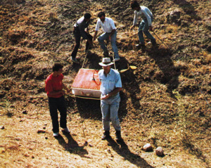
In 1987 Bayraktutan and Baumgardner, with a suitably qualified team (including Fenner), conducted systematic, detailed geophysical surveys of the type routinely used by mining companies, involving sophisticated instruments in order to find out what is below the ground surface. They completed a magnetometer survey, the instrument involved not only being capable of detecting shallowly buried magnetic/metallic objects, but also scanning deeply through the surficial cover into the bedrock below. This was followed up with a comprehensive ground-penetrating radar survey that systematically covered the whole formation from north to south along grid lines spaced two metres apart. In the time remaining the team completed three seismic survey lines longitudinally north-south to cover the entire length of the formation.
The same two investigators returned with another team in 1988 and this time brought with them a drill rig. Four holes were drilled and cored to a depth of 10 metres. Additionally, a much more detailed seismic survey with more sophisticated equipment was carried out.
The data from this drilling, and from these and other surveys, combined with geological mapping and sampling by these and other scientists, enables the conclusion to be made that this site has a perfectly reasonable natural geological explanation.
To begin with, contrary to the views expressed publicly by those who have lampooned Roberts here in Australia, the central outcrop within the formation on its western side is not an intrusion of igneous rock such as granite or one of its equivalents. Rather, the rock is a limestone that contains abundant microfossils (such as the tiny shells of the microscopic marine creatures called foraminifera), and a further less prominent outcrop of the same rock type occurs some metres to the north on the easterly side of the formation.
The same rock unit can be traced in a line, though offset in places, to the east and west of the formation, including an outcrop just outside the so-called visitors’ centre. This bed of fossiliferous limestone thus cuts right across the formation in an east-west direction and appears to dip steeply to the south. This can hardly be a rocky protrusion on which a ‘boat’ brought down by the surrounding mudflow from a higher elevation became snagged or impaled, as some (e.g. Roberts) would have it. On the contrary, this limestone bed is an integral part of the local geology and because it comes to the surface right across this boatshape the latter, obviously, cannot be a petrified wooden boat.
The other rock type on the site, and which predominates in the surrounding area, is basalt, a rock that is produced by the cooling of molten lavas that have flowed from volcanoes, such as Greater and Lesser Mount Ararats. In the local area, including on Greater Mount Ararat, the basalt has features that are evidence of it having cooled on the ocean floor (that is, under water). While there appears to be no outcrop of basalt within the boat-shape formation, there are numerous basalt boulders on the surface, half-buried in the surface mudflow material, and also buried and later exposed in the hardened mud which makes up the formation’s ‘walls’. Indeed, because of the appearance of some of these boulders in the mud, to the untrained eye they could easily be mistaken for petrified wood, as appears to have been done. Yet every sample from the site that others have suggested might be petrified wood has under the microscope always been basalt.
The magnetometer survey produced absolutely no evidence of any buried metal artefacts, regular patterns or ‘iron lines’. But it did clearly show the presence of three rock units trending east-west across the formation under the surficial mudflow material, plus the presence of a fault trending north-south right down the centre. Indeed, the fault has quite clearly offset the central fossiliferous limestone bed, which is also evident from the outcrops already mentioned above. The ground-penetrating radar scans also pinpointed this fault, particularly in the northern part of the boat-shape. In the same area the radar picked up a clear sub-horizontal reflector, representing a rock boundary at a depth of between six and eight metres below the centre-line ‘hump’ within the formation. The seismic surveys confirmed the presence of that rock boundary, and suggested that it was at a shallow depth in the central portions of the boat-shape.
Finally, the drilling intersected basalt at between six and seven metres depth in the northern portion of the boat-shape, exactly the depth predicted by the radar and seismic work, and exactly the rock type predicted by the magnetic response in the magnetometer survey and present in the mudflow material as boulders at the surface. In the southern portion of the boat-shape the drilling intersected a different rock type, as indicated by the magnetic response in the magnetometer survey, which was very strongly deformed and strongly folded. Between these two drill-intersected rock types is the fossiliferous limestone outcrop, making up the third rock type cutting across the site, as predicted by the magnetometer survey.
The significance of these drilling results should not be lost. Whereas the investigation team were hopeful that the reflector indicated by the radar and seismic surveys was in fact the petrified wood of the deck of the Ark, the drill intersections of solid basement rock below the surficial mudflow and weathered material immediately ruled out any petrified Ark or its remains within this site. Indeed, if this site had contained the Ark one would have expected the ‘boat’ to have not only been covered in with all this mudflow material, but full of mud inside, so there should not have been any basement rock intersected before the bottom of the conjectured ‘hull’ structure was reached.
Then how could this rather convincing looking boat-shape have been produced by natural means at this site, and how is it that it was only recently exposed to view? To answer these questions we need to look at the broader perspective. The boat-shape is situated in a sloping valley and is surrounded by deposits of loose soil and crushed rock which is slowly sliding down hill, flowing much as a glacier flows-a mudflow. As we have seen, the stable area around which this mudflow material flows is an uplifted block and erosional remnant of basement rock, including limestone and basalt. Just as water flows around a rock in a river bed, the site has acquired a streamlined shape due to the dynamics of the slowly flowing mud.
However, added to this is the fact that not only have the geophysical surveys revealed a fault right down the north-south centre-line of the boat-shape, but geological mapping indicates that there is a fault right along the western edge of the boat-shape and other faults in the valley floor. It is thus significant that this boat-shape first came into view as a result of an earthquake in 1948, and then its relief compared to the surrounding terrain was enhanced as a result of a further earthquake in 1978.
This clearly implies that the earthquakes caused ground movements in this area which pushed up this block of basement rock and some of the mudflow material draped over it. Some of this movement occurred along the fault down the western margin of the boatshape, thus giving the almost near-vertical ‘walls’ which now define so graphically that portion of the outline of the boat-shape. Thus the ‘walls’ at this point are really what are known in geological terminology as fault scarps (that is, cliffs caused by earth movements along faults).* (*A fuller treatment or the technical details and results from these geophysical surveys, the core drilling, and the geological sampling and mapping is planned for a future issue of the Journal of Creation.)
So there is no mystery about this site and its boat-shape. For the many who had their hopes built up that this may be Noah’s Ark, it needs to be kept in mind that the Bible in no way says that Noah’s Ark would be preserved as a witness to future generations. Nevertheless, it certainly would be an exciting and powerful testimony to an unbelieving world for the Ark to be found, but if that is to happen it will be unmistakably God’s doing in His time and in His way to bring Him the glory. In the meantime, as Christians we need to always exercise due care when claims are made, no matter who makes them, and any claims must always be subjected to the most rigorous scientific scrutiny. If that had happened here, and particularly if the scientific surveys conducted by highly qualified professionals using sophisticated instruments had been more widely publicized and their results taken note of, then these claims would never have received the widespread credence that they have.
There is an enormous amount of evidence for creation and the Flood, so we don’t need the Ark to be discovered in that sense. Also, the opposition to that evidence and to the clear teaching of the Scriptures, Peter reminds us, is because scoffers are ‘willingly ignorant’ (2 Peter 3:3–7)—it is a spiritual issue. As Christians, we need to do as 1 Thessalonians 5:21 states: ‘Prove all things; hold fast to that which is good.’
The People Involved
Ron Wyatt
A nurse anaesthetist from Madison, Tennessee, Ron is a self-styled ‘biblical archaeologist’ who claims to have found virtually every archaeological site of interest to Christians. His alleged ‘finds’ are nothing short of astonishing and include:
- The true site of the crucifixion
- The Ark of the Covenant
- The true Mount Sinai (with a plaque announcing it as such)
- The site of Korah’s earthquake
- The true site of the Israelites’ Red Sea crossing, also with a marker ‘built by King Solomon’ as a memorial
- Chariot wheels from Pharaoh’s drowned army
- The actual rock Moses struck to release water
- Noah’s Ark (the site discussed here, for which he has been the prime promoter)
- Noah’s grave
- Noah’s house
- Mrs Noah’s grave (containing a fortune—her gold and jewelry)
- Moses’ stone tablets containing the Ten Commandments, held together with golden hinges.
There are more claims like these. Could Ron Wyatt have found and solved problems that have baffled professional archaeologists for more than a century, or is there another explanation? Ron invariably has an ‘explanation’ of why he can’t direct others to see all this hard evidence for themselves at these sites’. His occasional seemingly convincing ‘documentation’ (including video-tape) repeatedly withers under independent scrutiny and/or conflicts with the on-site eyewitness testimony of several of his co-expeditionaries. [Ed. note: Wyatt died in 2000]. Return to text.
David Fasold
A former merchant navy officer and reputed to be a marine salvage expert, David Fasold worked with Wyatt and his team in 1985 and 1986, but then parted company. As he says, ‘Today, about the only thing Wyatt and I can agree upon is that these are the Ark’s remains.’ Fasold believes that the Ark was made of reeds held together by cement. He is reported as saying that originally he was a fundamentalist Christian, but has since lost all faith in Christianity. He is now openly hostile to literal belief in the Bible and apparently believes in several ‘floods’. [Ed. note: Fasold died in 1998.]
Dr Allen Roberts
With an academic background in history and Christian education, Allen Roberts first became interested in the site in 1960, but didn’t visit it until 1990. While attempting to visit the site again in 1991, both he and Wyatt were kidnapped with three others and held for three weeks by Kurdish guerrillas, an event which brought much media attention. An Australian organization called Ark Search formed around Allen to help raise funds for him to go back to Turkey and conduct a full-scale archaeological dig at the site with Wyatt. In the first half of 1992 he conducted a public lecture series around Australia which again drew much media attention. Yet, while obviously sincere, it appears that Allen has taken much of the evidence merely on Wyatt’s say-so, unaware of the results of the 1987–1988 geophysical surveys and core drilling, for example.
John Mackay
A former school science teacher (and one-time editor of the Creation magazine), John has, while disclaiming complete commitment, persistently and widely marketed the Wyatt video, by mail and at his own public meetings. He has negotiated with Ark Search to also market a video of Allen Roberts’ lecture. He is credited by Roberts as having identified a specimen as coprolite (fossilized animal dung), as well as having visually ‘positively identified’ the so-called laminated petrified wood sample as ‘pecky cypress’. John has visited Wyatt, evidently twice, at his home and states that he has been invited to join Wyatt’s next expedition. Trading (with his spouse) as Creation Research Centre he has actively publicized Wyatt’s evidence (e.g. the ‘fossil rivet’) and defended Wyatt’s ‘Ark’ claims in his newsletter.
Sevkit Ekinci
Governor of the Turkish Province of Agri and reputed to be a friend of Wyatt, he is the Chairman of the provincial Noah’s Ark Commission whose research team was the only group to return a cautious open finding on the site (the two others were negative). He was the one to declare the site a National Park with archaeological significance and who had the visitors’ centre built there. One would think that if he really believed the site contains the remains of Noah’s Ark he would have authorized a dig years ago, but he has a number of times intervened to stop a dig. He and others may not want to run the risk that excavation shows it not to be the Ark, and thus have no further tourist potential.
Dr William Shea
Formerly Professor of Old Testament at Andrews University, Berrien Springs, Michigan, he is now Associate Director of the Biblical Research Institute in Silver Springs, Maryland. He has promoted interest in the site, drawing attention to it in articles published in the Creation Research Society Quarterly, Origins and Archaeology and Biblical Research. He finally visited the site in 1986. While intrigued by the boat-shape, he has no faith in Wyatt’s claims about artefacts from the site, and once received a ‘petrified wood’ sample from Wyatt which turned out to be basalt. He totally dissociates himself from all of Wyatt’s other claimed archaeological finds, and appears not to trust Fasold. He indicates he would be equally happy if the site was confirmed as a natural geological formation, which he concedes is certainly suggested by the evidence. Return to text.
Tom Fenner
Geologist/geophysicist/applications engineer with Geophysical Survey Systems, Inc., who originally went to Turkey to do radar scans on the site for Wyatt in 1985, and who is often quoted as concluding from Wyatt and Fasold’s 1986 radar survey that the site is a man-made boat. However, he eventually went to the site with Baumgardner in 1987 to conduct his own full-scale radar survey with equipment he has professionally used in various parts of the world for many years. He says, ‘With the available scientific evidence to date, my opinion is that any statements claiming the authenticity of this site as Noah’s Ark or it being a man-made formation by individuals knowledgeable of these studies is at best wishful thinking and at worst an outright deception.’
Dr John Morris
With a Ph.D. in Geological Engineering and Administrative Vice-President of the Institute for Creation Research, San Diego, John has made 13 trips to Turkey in search of the Ark. He has twice visited this Durupinar site and come away convinced that it is not the Ark. His attention understandably has been focused on Greater Mount Ararat because of all the eyewitness testimonies. He has freely given advice and support to other groups, no matter where they wanted to search in the area.
Dr Salih Bayraktutan
Geologist and Director of the Earthquake Research Centre at Ataturk University, Erzurum, and a member of the Noah’s Ark Commission of Agri Province, he has repeatedly investigated the site since 1985, including geophysical surveys and core drilling in 1987 and 1988 in a joint project with Dr John Baumgardner and others. He has cautiously kept his options open, but has definitely not concluded the formation to be Noah’s Ark. He disputes such claims made by others, suggesting that not only are they are exaggerating, but some have even used false samples. Return to text.
Dr John Baumgardner
With a Masters Degree in Electrical Engineering and a Ph.D. in Geophysics from the University of California (L.A.), John works in the Theoretical Fluid Dynamics Research Group at the Los Alamos National Laboratory, New Mexico. John was quite positive about the site after his initial visits there with Wyatt, but after conducting professional geophysical surveys there in 1987 and 1988, and particularly after considering what the core drilling revealed in 1988, he eventually very definitely changed his mind and now is convinced that it is a natural geological formation. See also Interview in Creation magazine. Return to text.
Information Sources
- Baumgardner, Dr John—circularized family letters dated October 1985, 3 July 1987, and 19 August 1988.
- —numerous personal letters and faxes, 1991–92. –numerous phone conversations, 1992. –numerous face-to-face conversations, April 24, May 3, 1992. –unpublished site topographic data.
- Baumgardner, Dr John and Bayraktutan, Dr Salih, 1987. July 1987 geophysical investigation of Noah’s Ark (Durupinar site) Mahser Village, Dogubayazit, Agri. Report submitted to the Governor of Agri Province as Chairman of the Agri Province Noah’s Ark Commission. Bayraktutan, Dr Salih-numerous telephone conversations, 1992. —unpublished 1988 seismic survey data.
- Brandstetter, Dr Bernard-face-to-face conversations, July 1992.
- Burdick, Dr Clifford, 1976. The elliptical formation in the Tendurek Mountains. Creation Research Society Quarterly 13(2):96–98.
- Crouse, Bill, 1988. The Durupinar site. Ron Wyatt. are his claims bona fide? Ararat Report, No. 17, Christian Information Ministries International, Texas.
- Fasold, David, 1988. The Ark of Noah, Wynwood Press, New York.
- Fasold, David, 1992. The Noahide Society’s Ark—Update, Issue No. 5 (January/February, 1992).
- Fasold, David, 1992. The Noahide Society’s Ark-Update, Issue No. 6 (March/April, 1992).
- Fenner, Thomas J. –telephone conversations, 1992 –faxed letter, July 22,1992.
- Lang, Walter, 1990. The Ark Today, January-February, 1990, p. 11.
- Lang, Walter, 1991. The Ark Today, January–February 1991, pp. 3–6.
- Mackay, John B., 1992. Creation News 6(2):4.
- Mackay, John B., 1992. Brochure advertising Wyatt’s Noah’s Ark video.
- Morris, Dr John D., 1990. That boat-shaped rock … Is it Noah’s Ark? Creation 12(4):16–19.
- Morris, Dr John D., 1990. The boat-shaped formation. Ararat Report, September–October 1990, pp. 3–5.
- Morris, Dr John D., 1992. The search for Noah’s Ark: Status 1992. Unpublished manuscript.
- Morris, Dr John D.-face-to-face conversations, April 1992
- –various faxed letters, 1991–92. –unpublished notes Roberts, Dr Allen S., 1992. If this is not Noah’s Ark- then what is it? Ark Search, Sans Souci, Sydney.
- Roberts, Dr Allen S., 1992. Noah’s Ark Research Project (Ark Search) Newsletter, No. 2.
- Roberts, Dr Allen S., 1992. Documents openly shared from his evidence files at a witnessed personal meeting on June 11, 1992, including the various laboratory reports on rock samples and assay results, plus the Madison, Tennessee newspaper clipping.
- Roberts, Dr Allen S., 1992. Noah’s Ark Research Foundation Project, Lecture 1992. Video recorded by Ark Search at the Prince Alfred College Auditorium, Adelaide.
- Shea, Dr William H., 1976. The Ark-shaped formation in the Tendurek Mountains of Eastern Turkey. Creation Research Society Quarterly 13(2):9095.
- Shea, Dr William H., 1981. A review of recent data from the region of the Ark-shaped formation in the Tendurek Mountains of Eastern Turkey. Origins 8:77-92.
- Shea, Dr William H., undated. The present status of surface and technological study of the ship-shaped formation in the Tendurek Mountains of Eastern Turkey. Unpublished manuscript.
- Shea, Dr William H., 1988. Noah’s Ark? Archaeology and Biblical Research 1(1):6-14.
- Shea, Dr William H.-telephone conversation, July 1992.
- Stark, Reinhard, 1992. In search of Noah’s Ark: An interview with Dr Allan (sic) Roberts. Nexus, January-February 1992, pp. 37-40.
- Steffins, Marvin, 1984. Has Noah’s Ark been found? Christian Inquirer, November 1984, pp. 1, 7.
- Taylor, Paul S., 1992—faxed letters.
- Wyatt, Ron, 1989. Discovered: Noah’s Ark, World Bible Society, Nashville.
- Wyatt, Ron, 1986. Original copies of the 1986 radar survey scans.
- Wyatt, Ron, 1991(?). Noah’s Ark Found?. Video produced by Wyatt and others and distributed in Australia by Mackay.
- Wyatt, Ron, 1992. Unpublished interview with Joel Plotnek in Melbourne on 3 January 1992.

Readers’ comments
Comments are automatically closed 14 days after publication.