

NASA animation exposes ice age land bridges
Have you ever wondered what a map of the world would have looked like during the Ice Age? An upgraded NASA video can give you a glimpse into that past by slowly draining the water from the world’s oceans revealing the incredible landscape underneath.
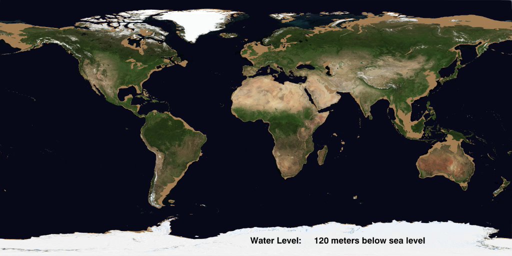
James O’Donoghue, formerly of NASA, and currently of the Japan Aerospace Exploration Agency (JAXA), edited the timing of the NASA animation and added a depth gauge to show how much had been drained away as it accumulated on the land as ice. (The animation does not show these huge ice sheets at the northern and southern portions of the globe.)
“Rather surprisingly, there’s a lot of undersea landscape instantly revealed in the first tens of meters,” said O’Donoghue. “When the last ice age occurred, a lot of ocean water was locked up as ice at the poles of the planet. That’s why land bridges used to exist. Each of these links enabled humans to migrate, and when the ice age ended, the water sort of sealed them in.”
Biblical creationists have long proposed that after the Noahic Flood some 4,500 years ago, there was an Ice Age lasting between 500–700 years, which occurred as a direct result of the Flood (see creation.com/ice-age).
The exposed land bridges during this period not only facilitated human migration, but animal migration also. This animation offers a peep back at the world that our ancestors navigated which now lies under a watery abyss.
- McFall-Johnsen, M., NASA slowly drains the oceans in an incredible animation, revealing hidden underwater mountain ranges and ancient land bridges, businessinsider.com, 2 Feb 2020.
Readers’ comments
Comments are automatically closed 14 days after publication.