
Interpreting the geology of Central Australia using Noah’s Flood
A geological guide book reveals landmarks, patterns, and puzzles

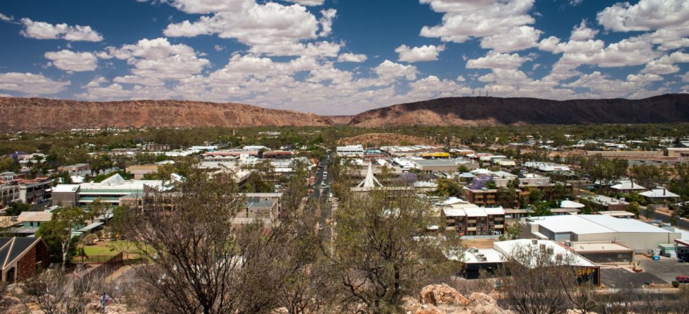
A few years ago, I arranged a geological excursion at Alice Springs, a remote town in the middle of Australia (figure 1), and in the process I needed to research the geology of the region. My first step was to find information, but there was no material available from a creationist perspective. However, there was a lot of other helpful geological information, including a guidebook by R.B. Thompson entitled “A guide to the geology and landforms of Central Australia”.1 It is a detailed, well-referenced guide that summarises published information covering the whole ‘geological history’ over a wide geographical area. As I worked to connect the geology of Central Australia with Noah’s Flood, I skimmed the geological history set out in the book. This was long and detailed, and to illustrate how extensive it is, I’ve reproduced the headings in table 1. My question was, where can we link this history with the Bible?
From previous experience I found that one useful ‘landmark’ is the point where the waters of Noah’s Flood change from rising to falling, because this involves a reversal in the way the water and sediment moved on the land. For example, I found that the sediments containing the Great Artesian Basin in Eastern Australia were the last major deposit as the floodwaters were rising. Mainstream geologists assigned these sediments to the Mesozoic, as beginning in the Late Triassic and ending in the Late Cretaceous (see figure 2 for geologic column). After the Cretaceous, that is during the Tertiary, the floodwaters receded into the oceans and the water level on the continent went down. I found a similar situation for the rocks in Western Australia around Perth, and southern Africa.2 On Table 1 it can be seen that the Tertiary is the very last of the long series of geological items in the geological history.

Using this and other information, I was able to include on the chart of the geological column (figure 2) coloured arrows denoting biblical history. Thus, this chart is now a preliminary guide for converting the evolutionary scheme into a biblical one. Those arrows show the waters of the global Flood peaking around the end of the Cretaceous, after which they recede. The arrows are shown as overlapping because the exact point varies from place to place and because there is not a one-to-one relationship between the geologic column and the Bible. One reason for this is that the criteria used by uniformitarian geologists to assign rocks to the column are not necessarily valid for Flood geology. Another reason is that water levels and water currents varied at different times over different parts of the continent. Thus, the timing of each geological feature shown on the column needs to be assessed for a Flood framework using criteria relevant to the Flood.
Widespread erosion
So, I began looking at the guide to Central Australia at around the Cretaceous/Tertiary boundary, starting with the Tertiary. The section headed “Tertiary (65–1.6 Ma)”3 begins, “The geological history of central Australia during the Tertiary period was initially one of widespread erosion and deposition in hollows.”

Right from the start, the description “widespread erosion” suggests that we are looking at the Recessive stage of the Flood. Erosion during the Recessive stage followed a definite sequence that can be identified in a landscape. First, the sheet-flow phase carved a plane, flat land surface, which was later dissected into valleys and gorges by the channelized-flow phase.
The sheet phase began when the floodwaters peaked, and water covered all of Australia, probably to a depth of a kilometre or more. With all land submerged, the floodwaters would have been free to move in sheets over the continent, eroding the surface flat. Computer simulations of ocean currents on the continents when the sea levels were high show that the earth’s rotation would generate circulating currents. Without land obstructions these currents would reach a high velocity,4 and rapidly erode the land surface.
Then, as the waters receded, some land eventually emerged, causing the water to flow in wide channels around these obstacles. Thus, the water eroded wide valleys into the previously-level surface. As the flow further reduced, it carved narrower gorges. Thus, the initially-flat and level surface would have been dissected by later Flood run-off.
An earlier guide to the Alice Springs area by T. Quinlan5 said this of the Tertiary: “Period of Tertiary Deep Weathering—Earth movements after the Mesozoic Era brought the whole of the area above sea level and this was followed by a long period of erosion and weathering.” It is fascinating how geologists recognize this period of continental uplift when the area was lifted above sea level. This description fits with the tectonic processes that occurred in the middle of Noah’s Flood as the continents began to rise and the ocean basins began to sink. Notice that uniformitarian geologists envisage uplift followed by a long period of erosion whereas the biblical model envisages erosion before and during uplift (during the Flood) followed by a long period of minimal erosion (in the post-Flood era).
As I continued in Thompson’s guidebook, another line that pointed to the Recessive stage of the Flood read, “One feature of the landscape in the Alice Springs region is the remarkably level surface to which the summits of many hills rise, and this level represents the Late Cretaceous and Early to Mid-Tertiary land surface.” Describing this surface, the guidebook says, “This feature can best be appreciated by standing on the top of the MacDonnell Ranges near Mount Gillen, and on this elevated surface noticing the similarity in height of surrounding hill tops.” To illustrate this surface, Thompson includes a picture of the flat top of the Blatherskite Range, south of Alice Springs. All the ranges in the area have similar flat tops at a similar elevation as illustrated by the flat top of the Heavitree Range south of Alice Springs shown in figure 3. The top of this range is suggestive of the plane, flat surface that would have been carved early in the Recessive stage but has since been dissected.
A network of rivers and lakes
When Thompson refers to “widespread erosion and deposition in hollows” he says, “Many of the deposits were removed by later erosion.” Again, this is expected during the Recessive stage of the Flood. After the initial period of sheet erosion, the late Recessive stage would have been characterised by a network of rivers and lakes. With the flow rate reducing, sedimentary material would deposit in the larger bodies of water, or “hollows” as Thompson described them.
Thompson said, “The Early Tertiary history is difficult to piece together as there are few exposures of sediments of this age and even fewer which can be dated using non-marine fossils such as plant pollens”. The reason there are few exposures of sediments is that the period was one of erosion, not deposition. It was only after most of the floodwaters had drained and flows had greatly reduced that sediments were able to be deposited. These were isolated deposits and are characteristic of the late channelized phase of the Recessive stage.
Because the sediments are isolated, they cannot be correlated with each other by physical connections, hence the reference to fossils. Uniformitarian geologists envisage that different environments would have developed and evolved over millions of years, and so they use the fossils to link the isolated sediments together and decide their timing, assuming the changes are caused by evolution. However, from a Flood perspective, the order of the fossils would be determined by hydraulic sorting during the Flood; different types of vegetation would have accumulated in different areas as the floodwaters were receding. Fossils may still be useful in relating isolated deposits with each other, but we would need to check the timings assigned by uniformitarian geologists and look for anomalies.
Faulty climate interpretations
Thompson describes this channelized erosion phase and the formation of these localized basins but explains their formation incorrectly. “During the Miocene period 16 to 7 million years … the climate continued to be wet. Earlier east-west faulting and regional uplift had rejuvenated erosion and promoted the dissection of the very stable Tertiary erosion surface. … Hollows, some fault-bounded, became sediment traps.” This description matches the network of rivers and lakes that existed late in the Recessive stage. We disregard the million-year dates assigned to this period, which are based on uniformitarian assumptions, and link the events to the late Recessive stage of the Flood, which would be the last couple of months of that one-year event that took place about 4,500 years ago. Placing these sediments into the late Recessive stage of the Flood means that the interpretation of a wet climate is incorrect. The evidence of abundant vegetation and water was not due to a high-rainfall climate but to the drainage of the waters of Noah’s Flood, which were still transporting vegetation ripped up from the pre-Flood world.
Further pointers to energetic water flows are evident in the sediment trapped in these localized basins. Thompson says, “The boulder beds to be seen in the road cuttings along Namatjira Drive 60–80 kilometres to the west of Alice Springs are the product of this erosion and the size and roundness of the quartzite and silcrete boulders suggests that water was not in short supply.” Water not in short supply is what is expected during this phase of Noah’s Flood.
Because uniformitarian geologists do not accept the global Flood catastrophe, they interpret the evidence in terms of modern environments that persisted for multiple thousands of years. Rounded quartzite rocks point to flowing water which suggests to them a wet climate, hence the interpretation “the climate continued to be wet.” However, from the Flood perspective the rounded rocks were produced by the erosion and transport of rocks by the draining floodwaters. This illustrates how published climate interpretations based on uniformitarian assumptions are not necessarily correct and need to be checked and reinterpreted as necessary.

Thompson continues describing this phase of the Receding Flood. “In the Miocene, hollows became lakes and swamps in which some plant matter was preserved as thin layers of lignite. From an analysis of the preserved pollen it is deduced that reed swamps existed in a landscape of forests and grassy plains which enjoyed a cooler drier climate.” Based on their uniformitarian philosophy, they assume that the plants grew in the area where they were buried, from which they surmise the climate and the form of the landscape. The Flood perspective provides a different explanation. The plants were uprooted early in Noah’s Flood and transported into the area, probably many months after the Flood had been in progress. From figure 2, you can see that Flood sediments were being deposited from early in the Precambrian.
Thompson continues discussing the climate, again based on uniformitarian assumptions. “Elsewhere in Australia, rain forests were the dominant vegetation cover. Lignite has been found at depths of up to 90 metres by drilling into the Tertiary sediments at Ti Tree, Hale River Basin, Paddy’s Plain, Tempe Downs, Alice Springs farm area, near Santa Teresa and Ayers Rock.” Again, from a Flood perspective this vegetation was uprooted from other parts of the earth early in that event and buried very late. That changes the interpretation about climate and vegetation cover in Australia at that time. A sediment depth of 90 metres is a considerable thickness for slow-and-gradual processes, but consistent with the scale of the Flood catastrophe.
Fossil deposits raise questions
Thompson continues describing the process that produced the rocks at this time. “Late Miocene erosional debris deposited as siltstones and limestones in a lake or river environment, contain a rich fossil assemblage, the only one of this age found in central Australia. Bones and teeth of Diprotodon, an extinct wombat, freshwater crocodiles, wallabies and kangaroos are evidence of a thriving fauna living in much wetter conditions, about 7 Ma.” He is referring here to the fossil deposits found in the Waite Basin some 150 km north east of Alice Springs. One well-known site is at Alcoota Station where the above fossils have been recovered.6 These fossil deposits, the ages they have been assigned, and their identification raise questions typical of this part of the sedimentary record. That is, “Which deposits are Flood sediments, which are post-Flood, and where is the Flood/post-Flood boundary?”
Wombats, wallabies and kangaroos are native to Australia, which suggests that this is a post-Flood deposit. In this scenario, these land animals would be descended from the animals preserved on Noah’s Ark. It would have been many generations before they arrived in Australia, several hundred years after the Flood, at least. They would have colonised the area around central Australia, where they died, were buried and fossilized. That would mean that the fossils would have been buried several hundred years after the Flood (at least) during the post-Flood Ice Age,7 which is estimated to have taken some 500 years for the glacial cover on the other continents to build to its maximum, and two hundred years for it to melt back to today’s levels (see What caused the Ice Age). Glacial ice on the continents would have lowered the ocean levels allowing land animals to migrate between continents. The increase in ice cover during the Ice Age was caused by higher precipitation after the Flood caused in turn by the warmer oceans, which persisted for several hundred years. This high precipitation may have extended to central Australia and be reflected in the sorts of animals that lived in the area that were found fossilized in these sediments. However, there is a problem with this interpretation.
The sediments have been labelled as Late Miocene (7 Ma) but this is too early to have been deposited during the Quaternary glaciation, which, in their scheme, began some 2.6 Ma ago. So, either the Late Miocene date assigned to the fossils is wrong, or the identification of the fossils as Australian native animals is wrong. In other words, the dating of the sediments and identification of the fossils needs to be re-examined. This would involve assessing the characteristics of the sedimentary units, checking the identification of the fossils, and considering how these animals would have been fossilized in normal, post-Flood processes.
This discrepancy illustrates how it is often difficult to distinguish between Flood and post-Flood deposits. The reason in part stems from the fact that similar sedimentary processes were involved during both periods. Water draining in the final months of the Flood would have flowed in the large drainage channels carved earlier in the Recessive stage. The much-reduced water flow very late in the Flood would have occupied only a small part of these broad valleys. In the post-Flood period, the water flowing from the land would have flowed in the same valleys in the same direction and been similar in volume. Thus, it is difficult to distinguish between Flood and post-Flood sediments.
Post-Flood dry climate
Thompson continues with the interpretation of the climate. “Since that time [late Miocene] central Australia has become drier and since the Pleistocene glaciation 1 Ma to 40,000 years ago it has become warmer.” The uniformitarian dates he quotes are for the second part of the Ice Age. If the Flood ended some 4,500 years ago, this would be equivalent to the period from 4,300 to 3,800 years ago. This drying of the climate could be explained in a couple of ways, depending on the dating and interpretation of the fossil deposits.
First, the wet climate could be a uniformitarian misinterpretation of the sedimentary deposits. These did not form in a wet climate but very late in the Flood, which is why there is evidence of abundant water, vegetation, and animals. The later dry climate would then be typical of the climate in Central Australia since the Flood. In other words, the wet ‘climate’ is not a climate but late Flood water flows; the dry climate is typical post-Flood climate. In this scenario the sedimentary deposits would remain dated earlier than the Pleistocene glaciation. However, we would be looking to identify the animal fossils as not just native to Australia but to animals also found in other parts of the world.
Alternatively, the wet climate could indeed be a climate that was due to higher rainfall during the post-Flood Ice Age. Increased global precipitation during the Ice Age led to high rainfall in Central Australia with lush vegetation and abundant fauna. After the oceans cooled and the precipitation reduced, the climate dried and warmed. In other words, the wet climate persisted for a 500-year period during the early post-Flood Ice Age; the dry climate is now the typical climate since the Ice Age maximum. In this scenario the sedimentary deposits would need to be dated younger to be aligned with the Pleistocene glaciation. The animal fossils would have migrated post-Flood from the Ark, and their identification could remain as native to Australia.
Conclusions
When we need to investigate the geology of an area of the earth, we will not usually have a creationist assessment that we can refer to. However, a wealth of excellent geological information is generally available, researched by long-age geologists. This provides an excellent starting point. It is especially helpful to consult a big-picture overview of the region.
With this information it is important to disregard the multi-million-year dates assigned to the geological events and focus instead on the physical evidence. A good place to start looking is around the end of the Cretaceous which generally represents time the waters of Noah’s Flood peaked, and continental uplift began. This event in Earth history created distinctive landforms on the continents which nicely fit the biblical scenario and can be identified.
Puzzling situations will often arise. This is due to 1.) the way the secular geologists interpret the depositional environments, especially of late-Flood deposits, 2.) confusion between Flood and post-Flood processes, and 3.) the isolated nature of the geological deposits. It is important to be aware of the sorts of difficulties that can emerge so they can be identified and investigated. With these puzzling situations the biblical perspective leads to geological scenarios that can provide testable ideas. Our ongoing investigation of the biblical Flood and the evidence produced will greatly help our understanding of geology.
References and notes
- Thompson, R.B., A guide to the geology and landforms of Central Australia, Northern Territory Geological Survey, Alice Springs, 1995. Return to text.
- For the African situation uniformitarian geologists describe continuous sedimentation through the Permian, Triassic and early Jurassic periods and erosion during the late Jurassic and Cretaceous. Although they describe the Jurassic and Cretaceous as a period of erosion, the sediments would have been deposited as the waters were rising but eroded later during the Recessive stage. See Clarey, T.L. and Werner, D.J., creationicc.org/2018_papers/Use of sedimentary megasequences to re-create pre-Flood geography (http://creationicc.org/2018_papers/32%20Clarey%20megasequences%20final.pdf); in: Whitmore, J.H., (Ed.), Proceedings of the Eighth International Conference on Creationism, Creation Science Fellowship, Pittsburgh, PA, pp. 351–372, 2018; and Oard, M.J., The remarkable African Planation Surface, Journal of Creation 25(1):111–122, 2011. Return to text.
- Thompson, ref. 1, p. 88. Return to text.
- Baumgardner, J.R. and Barnett, D.W., Patterns of ocean circulation over the continents during Noah’s Flood; in: Walsh, R.E. (Ed.), Proceedings of the Third International Conference on Creationism, Creation Science Fellowship, Pittsburgh, PA, pp. 77–86, 1994. Return to text.
- Quinlan, T., An outline of the geology of the Alice Springs Area, 1959/40, Bureau of Mineral Resources, Geology and Geophysics, Canberra, p. 9, 1960. Return to text.
- Woodburne, M.O., The Alcoota Fauna, Central Australia: An integrated palaeontological and geological study, Bulletin 87, Bureau of Mineral Resources, Geology and Geophysics, Canberra, 1967. Return to text.
- Oard, M., Frozen in Time, Master Books, Green Forest AR, 2004. Return to text.


Readers’ comments
Comments are automatically closed 14 days after publication.