
Feedback archive → Feedback 2018
Noah’s Flood—the big picture
Almost bigger than we can imagine
Today’s feedback comes from Bryan R. of the United States who asks how the rocks were deposited during Noah’s Flood.

I want to ask a question about flood layers. How could all of our rock layers be deposited by the Flood? Wouldn’t we see a big uniform layer? I never understood this specific mechanism for how specific layers would’ve been deposited in the knife edge way we see today. The Lake Missoula flood is always used as an example but many geologists say there were many Lake Missoula floods. I want the specifics of how these rock were deposited in the way we see them today
CMI Geologist Dr Tas Walker responds.
Hi Bryan,
The Lake Missoula flood was a post-Flood catastrophe that demonstrates some of the effects of geological catastrophe. A number of geologists are uncomfortable with the large magnitude of the Lake Missoula flood, and the speed with which geological processes happened. Consequently they hypothesise that it consisted of multiple small floods spread over a long period of time. However, the evidence is compelling that there was only one Lake Missoula flood, that it was enormous, and that it produced immense geological change in a very short time (see Only one Lake Missioula flood).
As large as the Lake Missoula flood was, it pales compared to Noah’s Flood, which was orders of magnitude larger and lasted much longer. During Noah’s Flood, there would have been multiple localized catastrophes on the earth that were as large as or even larger than the Lake Missoula flood. Such catastrophes would have continued throughout the whole year of the Flood.
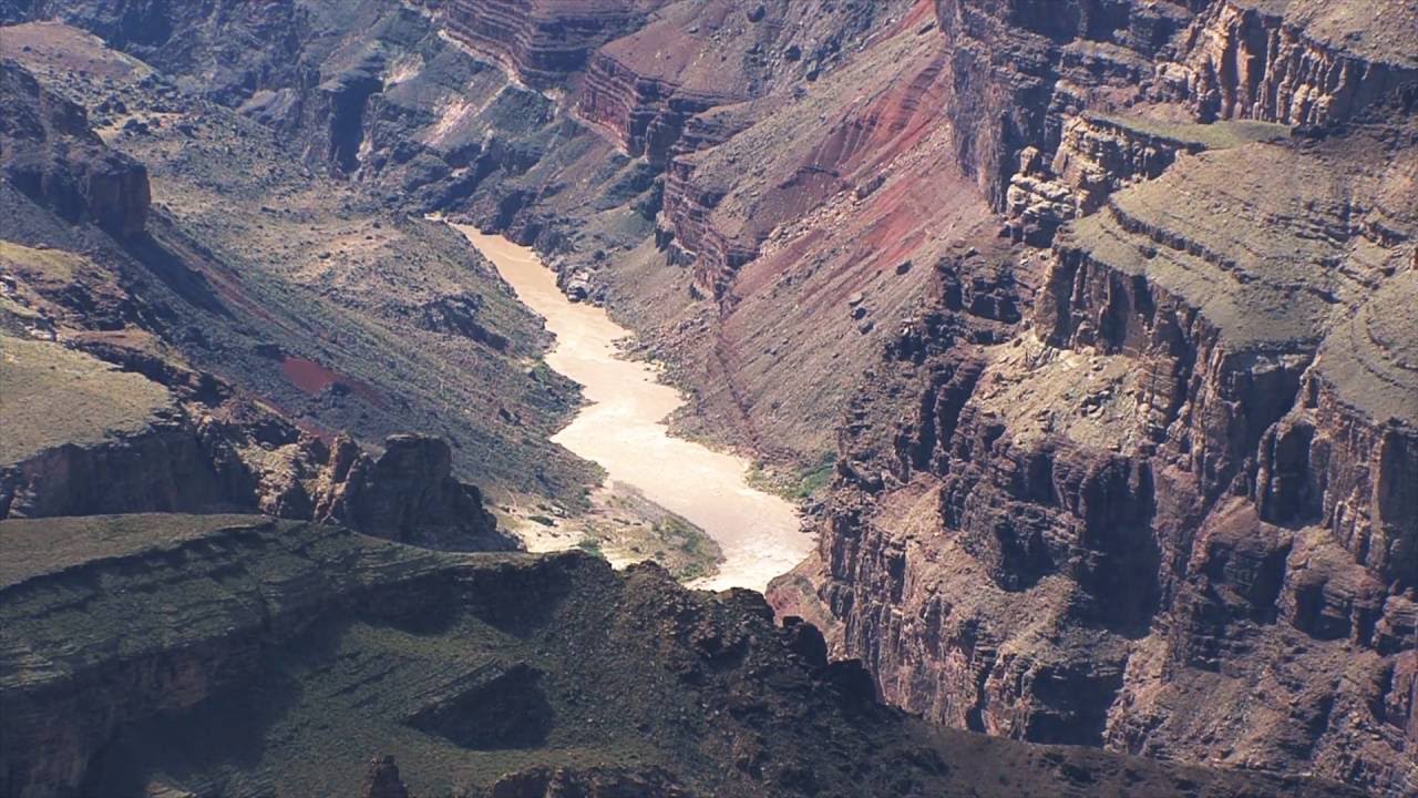
We need to understand that the Flood was an enormous catastrophe that occurred on the whole earth. It was characterised by an ongoing series of convulsions (tectonic movements) in the earth’s crust as the crust moved from its Pre-Flood configuration through a series of intermediate stages to its final post-Flood configuration. As an analogy to the episodic nature of the Flood catastrophe, we could envisage a golf ball rolling down a flight of stairs. Its journey consists of a series of sudden drops separated by a slow rolling along the tread: sudden drop, slow rolling, sudden drop, slow rolling, and so on, until it reaches its final stable position.
Geologists can identify the relative timing of crustal convulsions, which they call orogenies (or mountain building episodes). Each orogeny did the following. It folded, faulted, sheared, pushed, buried, uplifted, and metamorphosed the rocks already present on the earth in the region. At the same time it melted some of the rocks to produce magma, which was squeezed through faults and fissures, pooled in huge underground plutons, and erupted on the surface as lava. Further, the convulsion swept the floodwaters across the earth’s surface eroding the rocks, transporting, grinding, and sorting the eroded material, and then depositing it in sedimentary basins.
These convulsions occurred time and time again, and varied in their magnitude. They were most intense at the beginning of the Flood in its first ‘half’ (the Inundatory stage—see Using Bible history to interpret the rocks and landscapes), while easing off in the second ‘half’ (the Recessive stage). It’s because of this sequence of orogenies, which progressively disturbed the crust of the earth, that we do not see one big uniform layer, but a sequence of layers with different orientations, degree of disturbance, and geologic characteristics.
The last major convulsion was what mainstream geologists describe as the breakup of Pangea.1 This led to the opening up of the North and South Atlantic oceans and to the formation of the present continents in their present locations. Accompanying this process was a reduction in global sea level and the relative uplift of the continents. From a Flood perspective, this is connected with the second half of the Flood called the Recessive stage (see Using Bible history to interpret the rocks and landscapes). It involved a deepening of the ocean basins that caused the waters of Noah’s Flood to recede from the continents. Such an enormous movement of water from the continents eroded a great amount of rock material from the surface and transported it to the continental margin where it was deposited.

Figure 1 shows a preliminary conversion from the standard geological nomenclature into biblical history. Note that Figure 1 shows the first half of the Flood, the Inundatory stage, extending from the Archaean through to the end of the Cretaceous. In this period there were multiple orogenies. The Recessive stage extends from the top of the Cretaceous to the end of the Pliocene. As the caption indicates, the exact location of these boundaries is preliminary/indicative, and depends on the geological interpretation of a particular geographical location.
When examining geological maps and reports to understand the geology of a region, it is useful to examine the orogenies that are identified on the legend. You should be able to detect the general sequence of events described above connected with each orogeny. However, the mainstream geologists will have this sequence spread over many tens of millions of years or more, whereas the timing during Noah’s Flood would have been over days and weeks.
First look to see how the rocks older than the orogeny have been folded, faulted, sheared, and metamorphosed. Check how the geologists have described that disturbance. Next look for igneous rocks, either plutonic or subaerial deposits, emplaced after the orogeny. Then look for signs of massive water movements after the plutonic units (although they can often be partly synchronous). One such sign is massive erosion that has truncated sedimentary strata, while another sign is massive sedimentary deposits. Often the sedimentary deposits will have high energy units early on, such as conglomerates, and lower energy deposits later, such as sandstones, siltstones, shales, and limestones. And the contact between the eroded surface and the new sedimentary deposits is usually very flat like a knife edge. This is due to the large geographical extent of the high-energy, erosive water flows produced by the orogeny.
This is the big picture of Noah’s Flood. With this picture in mind it is possible to understand what Noah’s Flood has produced in a particular area.
All the best,
Tas Walker
Geologist, Speaker, Writer
Creation Ministries International—Australia
References and notes
- Many would be familiar with the work of John Baumgardner who simulated the break-up of Pangea on powerful computer models (see Probing the earth’s deep places). Many people concluded incorrectly that Pangea was the pre-Flood continent but it was always considered that the Flood began much earlier. The purpose of John Baumgardner’s models was to understand how such a break-up would have occurred. They showed that it would have proceeded very rapidly due to the unusual strength characteristics of the rocks comprising the earth’s mantle. Return to text.


Readers’ comments
Comments are automatically closed 14 days after publication.